|
 Welcome
to The Fall Creek Stream Guide! Welcome
to The Fall Creek Stream Guide!
We have put together an Easy
to Use and complete Guide to help you enjoy
this wonderful and scenic stream. We start describing
the river in Pendleton, Indiana and end in the heart of Indianapolis. There are currently no outfitters serving Fall Creek, so this website is designed to help visitors plan self-guided river trips.
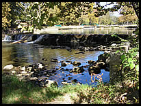
Fall Creek is very scenic and is teaming with wildlife.
The section that flows through Fort Harrison State Park in northeast Indianapolis is particularly nice, and we always see wildlife there.
How to Use this Website
We have identified the information that you will
probably need to plan your next trip to Fall Creek.
It is important to know about:
- Access Points
- We have printable maps to the access points
as well as detailed pictures of the parking, path
to the river, and river access for every
access point to the river.
- River Segments
- We have created printable maps of the river
segments that you will be traveling on. We show
you mileages, bridges and powerlines that you
will be going under.
- Current
Stream Flow - Click to find out how Fall
Creek is running right now!
We have included some interpretations of what
the flow level actually means in terms of the
feel of the river.
- Local Weather - See what the weather will be like on the day of your inteneded trip.
- Area Lodging - Find a convenient place to stay so you can enjoy a day or two on the water, and take in some other area attractions.
|

